London Stansted Airport (STN)
City Orientation and Maps
(London, England)
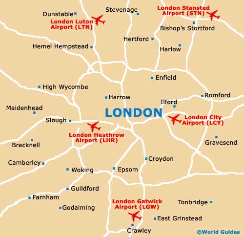
England's capital city, London is the big smoke and covers an enormous area. Divided by the River Thames, London is close to many notable towns and cities. These include Southend-on-Sea to the far east, Reigate to the south, and Cambridge to the north, past London Stansted Airport (STN).
Encircled by the busy M25 motorway, London is a sprawling city, with many enormous suburbs. Actively promoting public transport, London is famous for its underground trains, which connect most areas of the city, both in the centre and on the outskirts.
London Stansted Airport (STN) Maps: Important City Districts
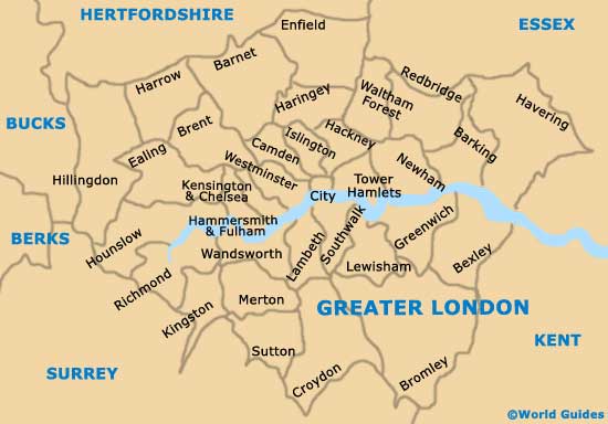
Within the city itself, London is divided into zones, relating directly to travel on the underground trains. Zone 1 is the heart of the city, incorporating Paddington, Piccadilly Circus, Tottenham Court Road, Leicester Square and Covent Garden. Spreading out to Zone 6, each of the zones are clearly indicated on maps of the London underground.
Much of London is divided into districts, where many of the top attractions can be found. These include Knightsbridge, Greenwich, Hackney, Fulham and Wembley, to mention but a few. The city contains a number of large train stations, amongst which Paddington is both the largest and busiest, located in the city centre, while both Waterloo and Kings Cross stations are also worthy of a mention.
England Map

Greater London Map
London Map